Ilocos Trip Day 2: Skipping Laoag & Pagudpud Northbound Tour
Day 2:
We checked out of Cordillera Inn at 7AM and headed towards Laoag. Most buses are non-airconditioned so we had to bear the 4-hour travel with dust and heat. We reached Laoag at 11AM and there we discussed should we want to continue the Laoag tour or not. Our mistake was we should have dropped off at Paoay and start the tour there. Since we were already in Laoag town proper, we didn't want to go back because it would mean travelling back for 30 minutes via tricycle. After much discussion, we all agreed to head up North, Pagudpud. We promised ourselves we will definitely go back for the Laoag tour next time in the future.
We spent another 3 hours in a minibus going to Pagudpud. Before reaching the town, we already saw the Bangui Windmills and Cape Bojeador from afar. At 2PM we arrived in Pagudpud's town proper and Kuya Lenzer, our tour guide/photographer/driver was waiting for us. I got Kuya Lenzer's contact number (09068185735) from a Forum (GirlTalk) as he is highly recommended there. True enough, he is nice and friendly. As for our accommodation, we stayed at Ate Cathy's Homestay (09195716680), also recommended by GT's for its cheap and clean rooms. You can ask Ate Cathy to cook food for you.
Pagudpud tour consists of Northbound and Southbound tour. Kuya Lenzer suggested that we start the Northbound tour so we wouldn't be cramming on the third day. Glad we took his advise.... At 3PM, we started the Northbound tour.
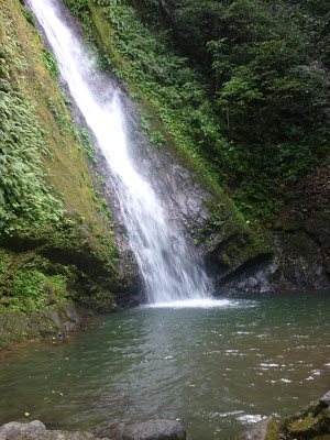
We first visited the Kabigan Falls. After we registered our names, we were accompanied by a tour guide. A tour guide is a must, for P100. We trekked for around 30 minutes including crossing rivers and when we saw the Falls, were so relieved that atlast the long walk was over, and at the same time excited. The water was cold but once we got used to it, it felt relaxing.
 |
| Kabigan Falls |
"It is an enchanting falls located at the eastern part of Barangay Balaoi and it is around 1.8 kilometers away from the national highway. This 80 feet waterfall is surrounded by thick forest and well-known for its concaved basin" -WikiTravel
 |
| Patapat Viaduct |
 |
| View of the China Sea |
"Patapat bridge is a winding bridge found at the foot of the cliff of the North Cordillera Mountain Ranges. It connects Barangay Balaoi and Pancian and it is around 1.2 kilometers long. This bridge is often referred to as the “French Riviera of the North”. Along the bridge, you can pass the Mabugabog Falls that serves as a source of power for the mini hydroelectric plant. It is only during the rainy days when it shows its splendor with its water dropping rhythmically to precipice on the rocky shore of the sea below."-WikiTravel
Next was Aqua Grande. We didn't enter the Aqua Grande because there’s really nothing special about the place. Just a freezing cold river full of big rocks that meets the sea. There is an entrance fee. But for those who wouldn't like to trek, they can go here instead.
 |
| Agua Grande |
Another spot was Paraiso ni ANton. Honestly, I didn't find anything interesting in here. Kuya Lenzer said this place was beautiful during Marcos' time. But now since no one was taking care of this place, for me it looked haunted.
 |
| Paraiso ni Anton |
We headed next to Timmangtang Rock... Timmangtang means "bell-shaped". it didnt look like bellshape to me but kuya lenzer said it was before.
 |
| Timmangtang Rock |
"Timmangtang rock stands majestically a few meters away from Bantay Abot caves. It is located along the shore and partly by the sea. You cannot separate Bantay Abot Cave from the Timmantang Rock for they are believed to be lovers, the former being the female and the later is the male. They are collectively termed as “Lover’s Rock”. This rock is like a bell-shaped, hence the name Timmantang. The rock is covered with grass and bushes. On top of it, you could see the calm blue sea and the enchanting view of Sitio Gaoa. Campfire is also very ideal at the foot of this stunning rock."-WikiTravel
 |
| Bantay ABot Cave |
"Bantay Abot Caves means "a mountain with a hole". A hole was found at the middle of the mountain where the waves were free to flash into its walls just like an open shore until it was wrecked by an earthquake during the 80’s. It is also called "the underground sea" for on top of the cave is a lustrous vegetative cover. Inside the cave is a church that once you are inside, you do not only hear the echoing sound of the waves, the chirping of the birds but you can also feel the cool breeze of the air. It is a favorite hangout of swallows that swarm to their roost in the late afternoon. It is a very unique creation partly surrounded by the clear blue sea. Its shore has white sand mixed with fragments of shells and rocks that can be made as a décor. Parts of the shore are forms of rocks where you can sit and relax and enjoy a lucid view of the wide sea and verdant mountains"-WikiTravel
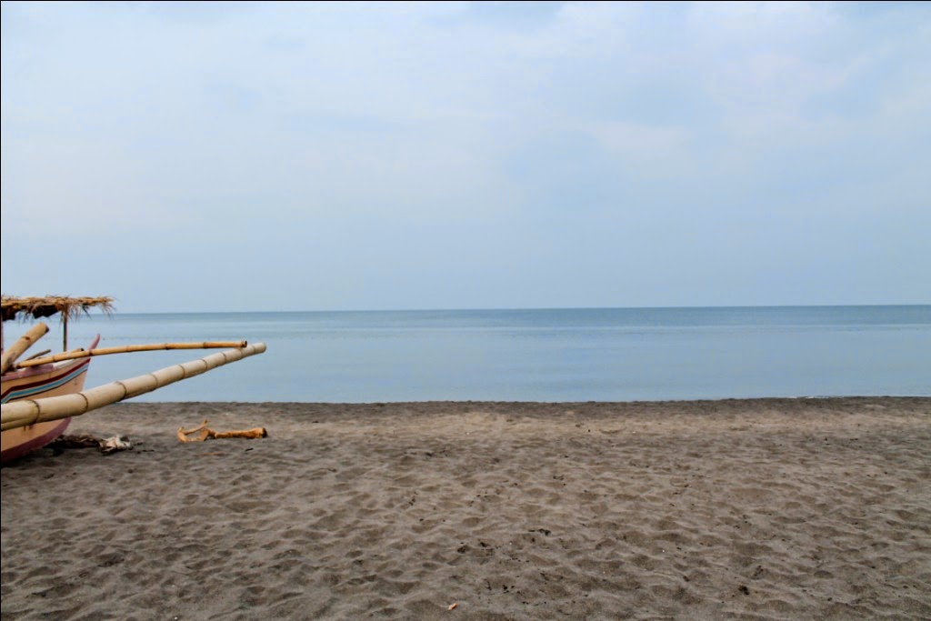
Our last stop was Blue Lagoon. Blue Lagoon is also known as the Boracay of the North for its white sand.
That was the end of the Northbound tour. It was already dark when we left blue lagoon. We bought fresh fish from vendors along the highway for dinner on our way to Ate Cathy's homestay. Ate cathy cooked food for us... yum yum!!! |
| Blue Lagoon |
 |
| Blue Lagoon |
" It is a hidden bay found at Maira-ira Point, which is a half-moon in shape edifice, by the Nacatnagan Cliff in the east and the Dos Hermanos in the north. This place is where you can escape the hustle and bustle of city life. Reaching the place is quite tiresome for it is around 2.5 kilometers away from the highway with rigged roads and it is found at the interior part of Sitio Malingay. On the way is thick forest and you can also have glance of the sea. Malingay Cove is famous for its crystal blue water and fine white sand."-WikiTravel
After satisfying our tummies, we slept early. It was another tiring day for us but then again, we enjoyed every bit of it. :)
Vigan - PagudPud Tour Part1
Vigan - PagudPud Tour Part3


